Keywords
desert encroachment, atmospheric warming, temperature, rainfall, humid tropics.
desert encroachment, atmospheric warming, temperature, rainfall, humid tropics.
Desertification has been noticed in the northern part of Nigeria since the 1920s, but its impact has become more noticeable since the famine of 1971–1973 (Cavalho, 2007; Audu and Adie, 2018). Olagunju (2015) reported that Nigeria is faced with rapid desert encroachment from a moderate to severe rate, and that out of 909,890 km2 of Nigeria’s land area, about 580,841 km2 accounting for 63.38% of the total land impinged by desertification. This reduction in annual rainfall implies a reduction in available soil moisture for crop production, which implies that more irrigation activities will be carried out to sustain crop growth, thereby increasing the cost of agricultural production. Dada et al. (2006) noted that desert encroachment is moving southward in Nigeria. Tercula (2015) recorded that Nigerian lands being lost to desertification amounted to approximately 350,000 hectares every year, and the effects were noticed in the environment and general livelihood of Nigerians. Desertification and flooding are two resultant impacts of climate change and global warming in Nigeria, which have led to serious economic damage and loss of life. The IPCC (2007) recorded that the climate of the Earth has been altering in the past millennium. These temperature variations can be attributed to the increase in greenhouse gas emissions. There are reports of global climate warming and changes in precipitation patterns in different regions (IPCC, 2013). This temperature rise and change in precipitation patterns are also anticipated throughout this 21st century, and the global temperature has been estimated to rise by 0.3 –0.7 °C by the year 2035 and by 1.7 –4.8 °C by the year 2100 relative to the baselines of 1966 to 2005 (IPCC, 2014)). The convention of the United Nations, (UNFCCC, 1992) in a bid to combat human interferences that are dangerous to our climate established an international treaty that was endorsed by 154 states at the ‘earth summit’ to ensure the stability of the concentrations of greenhouse gases in the atmosphere by allowing natural adaptation of ecosystems to changing climate, to make sure that the manufacture of food is sustained and also to ensure the sustainability of development of the economy. The COP ‘21 and COP ‘26 agreement signed respectively by 196 countries of the world has a target to reduce global warming to well lower than 2 °C or preferably 1.5 °C compared to the level of global warming before the industrial age and to achieve neutrality by mid-century. To achieve this goal, different countries have adopted different strategies. The Great Green Wall (GGW) initiative is an approach that the world is currently using to combat climate change and global warming, since it is affecting virtually everybody in the world. It was announced by the President of France and other leaders of the world at a planet summit which took place on the 11th of January 2021 (GGW, 2021). The Great Green Wall (GGW) has evolved from its initial concentration of planting trees to an encompassing initiative for rural development, which aims to improve the livelihood of the Sahelian people by creating streams of productive and green landscapes across 11 countries (Mauritania, Senegal, Nigeria, Mali, Niger, Djibouti, Ethiopia, Sudan, Eritrea, Chad, and Burkina Faso). The report of GGW (2021) states that over 19 billion US Dollars have been pledged by several multilateral and bilateral organizations at the summit to fund this project, but the amount that will be needed to actualize the goals of the GGW initiative by the year 2030 will be at least 33 billion US Dollars. The goals include the restoration of degraded lands of up to 100 million hectares, sequestration of 250 million tons of carbon, and creation of 10 million green jobs in rural areas.
The major objective of this study was therefore to assess the atmospheric warming and desert encroachment in Imo State, Southeastern Nigeria.
The specific objectives were:
This study was carried out in the Imo State in Southeastern Nigeria. Imo state lies between latitude 4°45′ N and 5°50′ N, longitude 6°35′ E and 7°30′ E, and covers an area of approximately 5,529.17 km2 (IMSG, 2008) with a Population of 3,927,536 (NPC, 2006). The State derives its name from the Imo River, which takes its course from the Okigwe/Awka upland. The Imo State is located between the lower River Niger and the upper and middle Imo Rivers in the southeastern part of the country (Amangabara, 2015).
Imo State has a humid and semi-hot equatorial climate. Imo State usually experiences heavy rainfall, with an average annual rainfall of 2000–2400 mm/yr, with approximately 152 rainy days occurring during the rainy season (i.e., from April to October), and the distribution of rainfall is bimodal, with peak rainfall in July and September with a break of two weeks in August. The rainy season begins in March and continues until the end of October or early November. Rains are usually highest at night and in the early hours of the morning. A high amount of rainfall supports a large quantity of runoff. Moreover, there are yearly variations in rainfall amounts, which are usually between 1,990 and 2,200 mm (Nigerian Meteorological Agency 2012). Relative humidity ranged from (75% to 90%) between the rainy and dry seasons. The temperatures all over the state are similar, with the hottest months from January to March, while the mean annual temperature is usually above 20 °C (Amangabara, 2015).
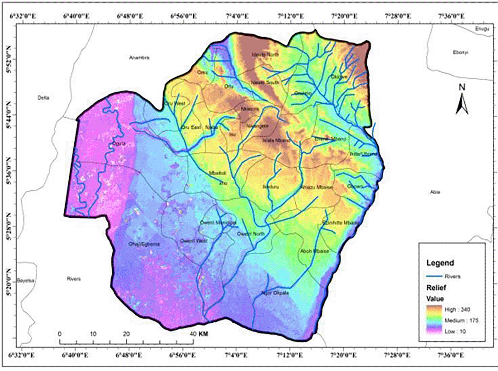
The relief in Imo State is made up of three major landforms: the first are the highlands with an elevation of approximately 340 m in the northern parts of the State, covering locations such as the Ideato, Ihitte-Uboma, Okigwe, and Orlu local government areas; and moderate lands with an elevation of approximately 175 m existing midway between the south and the northern parts of the state. The third landform is the lowlands in the southern part of the state, consisting of the river valleys of the streams that rise in the highland regions of the state and the lowland regions in the southern areas of the state, as shown in Figure 2.1. The floodplains used in this study were located in the third lowland landform.
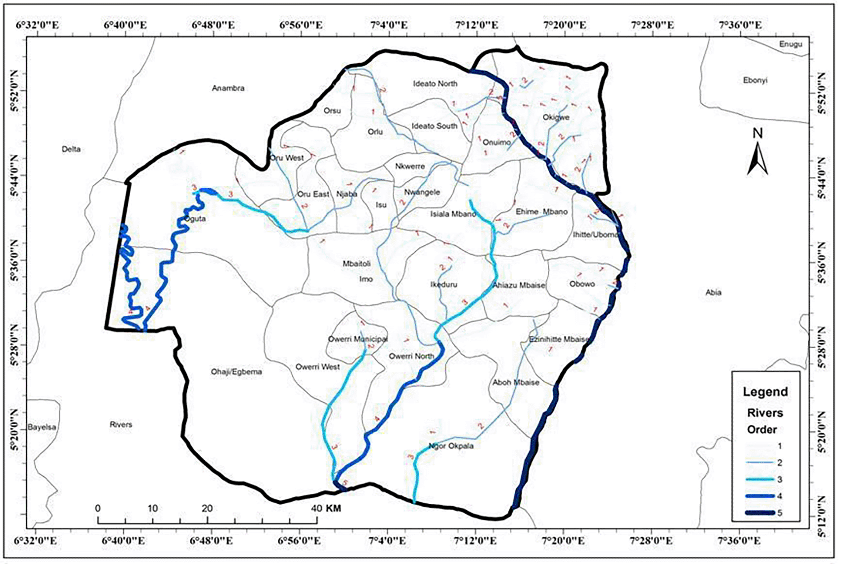
The Imo State has five sub-drainage basins, as shown in Figure 2.2, which make up the Imo Basin in the Anambra-Imo River Basin Area viz: Njaba/Lower Orashi, Ogechie, Otamiri, Upper Imo, and Upper Orashi. These five river sub-drainage basins comprise approximately three lakes and 51 rivers.
The climax vegetation of the study area is tropical rainforest consisting mainly of tall trees, thick bushes, shrubs, grasses, and other herbaceous plants, but most of these trees and bushes have been cleared and cultivated for building and other engineering construction activities.
The standing vegetation in the area consists of secondary forests, fallow lands ranging from one to several years of fallows, cultivated plantations such as oil palm plantations, rubber plantations, cocoa plantations, citrus plantations, and other annual crops such as maize, cassava, vegetable gardens, shrubs, grasses, and other herbaceous plants.
The socioeconomic activities of the area are mainly farming, fishing, trading, and other small businesses. They also practice traditional agriculture to grow arable crops such as cassava, potato, yam, plantain, okro, pepper, maize, eggplant, banana, and some perennial crops such as oil palm, rubber, and cashew. Commercial agriculture is also practiced in the area to a lesser degree, mainly in peri-urban areas, to supply food to the Owerri municipality. The bus-fallow system and organic manures are usually used for soil fertility regeneration, while land clearing is by slash and burn. Oil exploration and exploitation activities are carried out in the Ohaji/Egbema Local government area of the state. Cottage industries also existed in this state. Drilling of sand has also occurred in this area. Lumbering activities are also prevalent in forests. The people in the area are also in schools and hotel businesses. Some were civil servants.
Climatic data of average annual rainfall and temperature were used in this study for a period of 30 years from 1987 to 2016 using data from the Nigerian Meteorological Agency (NIMET). Rainfall and temperature data were divided into three decades from 1987 to 1996, 1997 to 2006, and 2007 to 2016 to study the variation in temperature over decades. Average monthly data were also collected to study monthly variation. Minimum and maximum atmospheric temperature data were collected, and the mean temperature and temperature range were obtained by calculation. The mean temperature was calculated from the temperature data by adding the maximum and minimum temperature data and dividing by 2, whereas the temperature range was calculated by subtracting the minimum temperature from the maximum temperature. Desert encroachment was assessed in the study area using the criteria for the evaluation of desertification status proposed by the FAO/UNEP (1984).
The coefficient of variation was adopted to estimate the percentage decadal variation in the climatic parameters studied. The patterns of the climatic parameters studied are presented using line graphs. Trend Analyses were also used to study trends in the climatic parameters in the study area. Regression analysis of climate variables over time was also performed to predict the rate of desert encroachment and regional warming in the study area.
The results of the climatic parameters of the study area are shown in Tables 3.1, 3.2 and 3.3. Table 3.1 shows the mean monthly climate data for Imo State (1987-2016). Tables 3.2 and 3.3 shows the mean decadal variations of the climate variables. It was divided into three decades: Decade 1 (1987-1996), Decade 2 (1997-2006) and Decade 3 (2007-2016). Table 3.4 shows the trend analyses of the climatic parameters of the study area. Table 3.5 shows the regression model for annual rainfall totals and mean annual temperatures. Figure 3.1 to Figure 3.3 show the graphical representation of the climatic variables in the study area.
| Decades | Maximum temperature (°C) | Minimum temperature (°C) | Annual rainfall (mm) |
|---|---|---|---|
| 1st decade | 32 | 23.1 | 2526.2 |
| 2nd decade | 32.5 | 23.84 | 2292.62 |
| 3rd decade | 32.5 | 23.7 | 2278.66 |
| Mean | 32.3 | 24.6 | 2365.5 |
| %CV | 1.1 | 1.9 | 13.9 |
| Decades | Maximum temperature (°C) | Minimum temperature (°C) | Annual rainfall (mm) |
|---|---|---|---|
| 1st decade | 32 | 23.1 | 2526.2 |
| 2nd decade | 32.5 | 23.84 | 2292.62 |
| 3rd decade | 32.5 | 23.7 | 2278.66 |
| Mean | 32.3 | 24.6 | 2365.5 |
| %CV | 1.1 | 1.9 | 13.9 |
| S/N | Parameter period | a (intercept) | b (slope) | r | Regression line equation |
|---|---|---|---|---|---|
| 1 | Mean annual T | -17.67 | 0.02 | 0.373 | y = 0.02x –17.67 |
| 2 | Annual rainfall | -29.398 | -13.50 | -0.445 | y = 29.398 –13.50x |
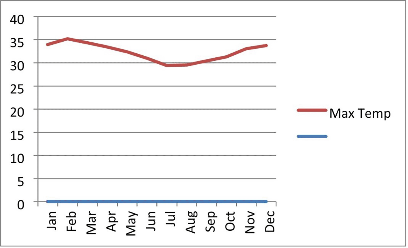

The maximum temperature data show a mean of 32 °C for the first decade, 32.5 °C for the second decade and 32.5 °C for the third decade. This indicates that the temperatures are suitable for dry matter production. They had low variation. The average monthly distribution of maximum temperatures was highest between January and December. The values started to decrease from February to July because of the onset of the rainy season. It started increasing again from August and peaked from December to January.
The minimum temperature of the study area showed that the first decade had an average of 23.1 °C, the second decade had an average of 23.8 °C while the third decade had an average of 23.7 °C. This shows that the average minimum temperature of the area favors crop growth and development. Mean variation was low.
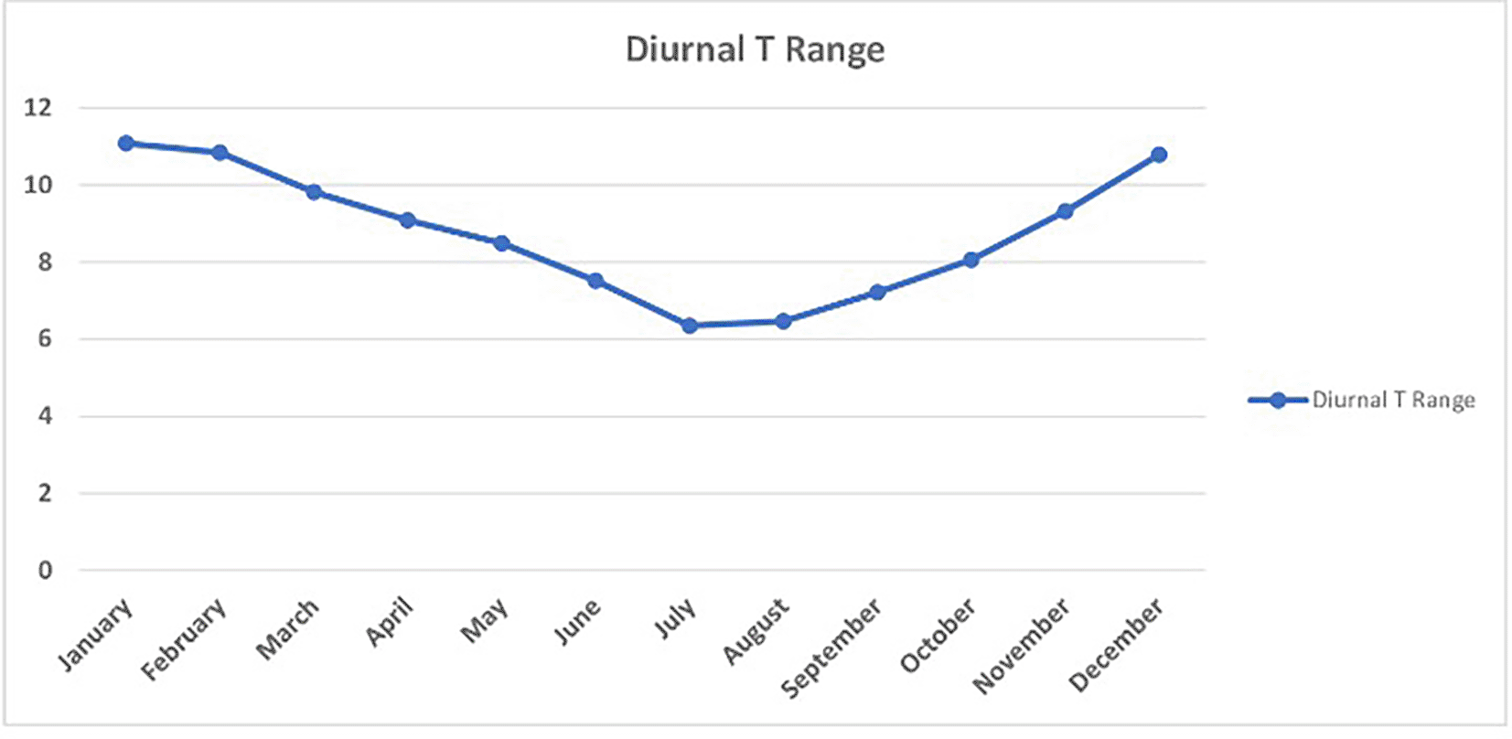
The diurnal temperature range results showed that the temperature range was highest from November to January. This value began to decrease until July. The wider the diurnal temperature range, the better it is for most crops, such as tomatoes. This shows that short-duration crops that require a wider diurnal temperature range can be grown from October to February.
The average annual rainfall was highest in the first decade, with a mean of 2,526.20 mm and the lowest in the third decade, with a mean of 2,278.66 mm. This shows a drop in annual rainfall as the years progressed. This is a surprising trend as this drop affects agricultural production by requiring more irrigation practices. The average monthly distribution showed that it was lowest in January, started to rise to a peak from July to September, and started dropping rapidly in December.
The trend analyses of the climatic parameters showed that the changes and percentage changes in maximum temperatures were negative from 1988 to 1991, revealing a reduction in maximum temperatures; then, they became positive from 1992 to 2016, revealing an increment in maximum temperatures; however, there were some negative values within the years, and it was zero in 2014.
The trend analysis of the minimum temperature revealed that the changes and percentage changes in minimum temperature were zero in 1988, meaning no change in 1998; it became negative in 1989, meaning a decrease in minimum temperature, but turned positive in 1990, indicating an increment in minimum temperature. The values became positive over the years, indicating an increase in minimum temperatures, although a few negative changes were recorded within the years.
The trend analysis for the mean temperature revealed that some years were positive while some years were negative, revealing a fluctuation between increase and decrease in mean temperatures. The trend analysis for annual rainfall revealed a positive trend in the earlier years, indicating an increase in rainfall amounts, but later became negative as the years progressed, revealing a reduction in rainfall amounts, although some positive years were recorded.
The relationship between the climatic variables and time was studied using correlation and regression analyses. The results are shown in Table 3.5 below.
The mean annual temperature correlated positively with time (r=0.373), but the total annual rainfall correlated negatively with time (r=-0.445).
The results in Table 3.5 reveal that, in Imo State the Mean annual temperature increases by 0.02 °C. This implies that Imo State is warming at a rate of 0.02 °C per annum. This finding corroborates the findings of (Nwagbara and Ibe, 2015). Their study revealed warming of Abia State by 0.03 °C and Enugu by 0.02 °C per annum. This implies the warming of south-eastern Nigeria. This can be attributed to the emission of greenhouse gases from soil, gas flaring, and other activities. Rising temperatures and changing precipitations are also expected throughout the 21st Century, with global mean surface temperature projected to increase by 0.3–0.7 °C by 2035 and 1.7–4.8 °C by 2100, relative to 1986–2005 baselines (IPCC, 2014).
The results in Table 3.5 reveals that annual rainfall totals are reducing by 13.50 mm annually. This is a surprising trend in Imo State because the increase in temperature and reduction in rainfall amounts in Southeastern Nigeria implies desert encroachment southward of Nigeria. Olagunju (2015) reported that Nigeria is faced with rapid desert encroachment from a moderate to severe rate, and that out of 909,890 km2 of Nigeria’s land area, about 580,841 km2 accounting for 63.38% of the total land impinged by desertification. This reduction in annual rainfall implies a reduction in available soil moisture for crop production, which implies that more irrigation activities will be carried out to sustain crop growth, thereby increasing the cost of agricultural production.
Desert encroachment was assessed in the study area using the criteria for the evaluation of desertification status proposed by the FAO/UNEP (1984). Figures 3.4 – 3.8 below shows the ratings of desertification in the study area using on-site and laboratory experiments. The ratings were placed into the following class limits:
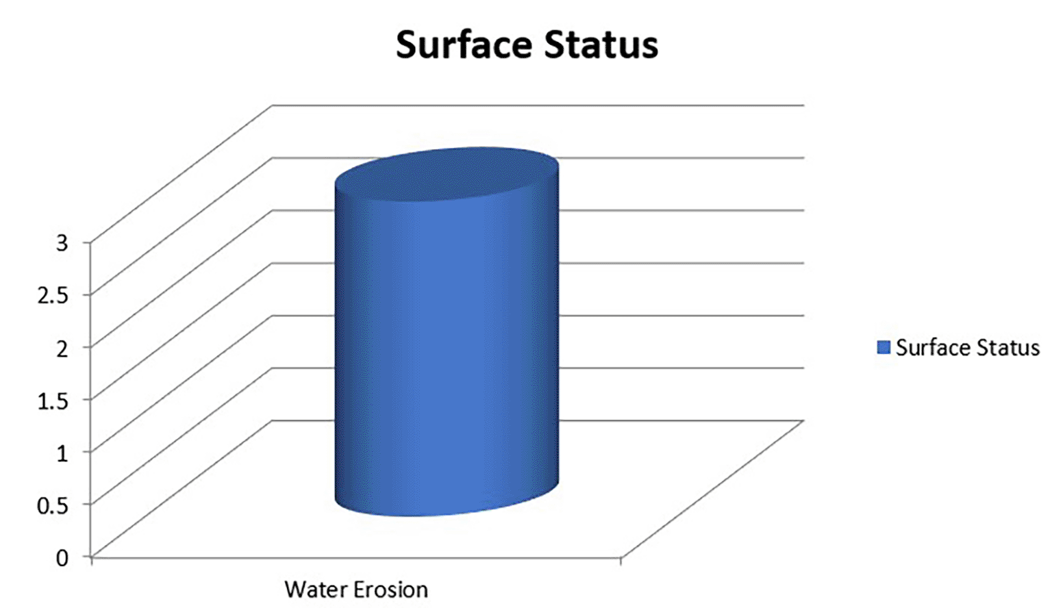

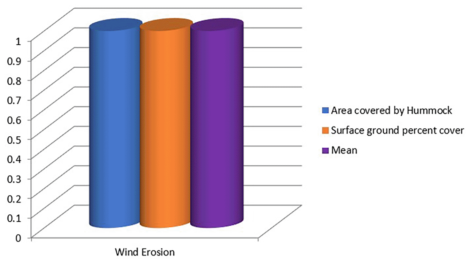
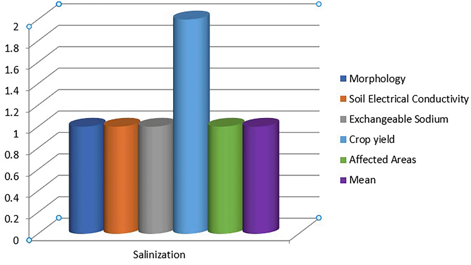
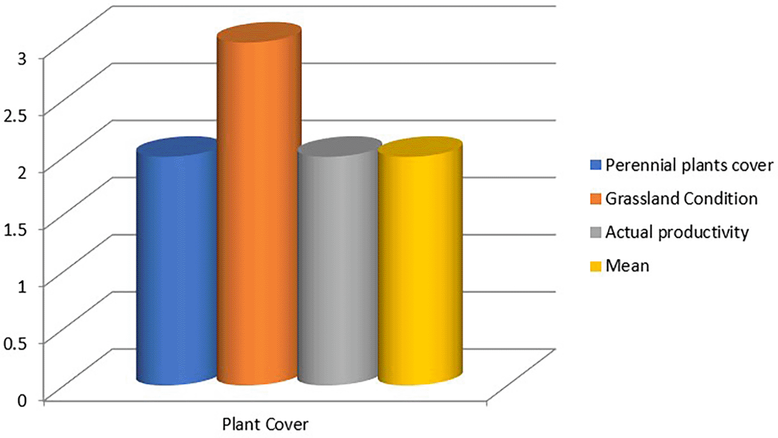
1 = Slight, 2 = moderate, 3 = severe, 4 = very severe.
The indices of desert encroachment in Figures 3.4 to 3.8 show that plant cover was rated moderate. This is because the area has lost most of its climax perennial vegetation due to rapid deforestation for road construction, buildings, and agriculture. This has increased in recent times because of population increase in the area. Water erosion in this area was rated as severe. This was evidenced by the different sheet, rill, and gully erosion sites in the area. This can be attributed to excess rainfall in the area, geologic soil formation in the area, and other anthropogenic factors. Rainfall amounts tended to decrease, as shown in Table 3.5, which is an index of desert encroachment. Wind erosion was classified as slight because it was not a major problem in this area. Salinization was also classified as slight because the soil was not saline and did not have salinity problems. Desert encroachment in the study area generally fell within the class limit of ‘moderate.’ This is in line with the publication of Olagunju (2015), who stated that Nigeria is faced with rapid desert encroachment from a moderate to severe rate and that out of 909,890 km2 of Nigeria’s land area, approximately 580,841 km2 accounting for 63.38% of the total land impinged by desertification. Dada et al. (2006) also noticed that desert encroachment is moving southwards in Nigeria, and Tercula (2015) recorded that Nigerian lands being lost to desertification amounted to about 350,000 hectares every year, and the effects were noticed in the environment and general livelihood of Nigerians.
This study revealed that there is moderate desert encroachment in the study area, and that the atmosphere of the state is also warming by 0.02 °C per Anum. There was also a reduction in annual rainfall totals by 13.50 mm annually. These issues of desert encroachment and regional warming in the area need to be checked before they escalate to become severe to very severe desertification. This can be controlled by reducing the remote causes of desert encroachment and regional warming, such as reducing deforestation, reducing greenhouse gas emissions in the area because greenhouse gases lead to global warming and climate change, and controlling water erosion in the area by encouraging conservation agriculture and mechanical means to control water erosion. Windbreaks and shelter belts should be planted to control wind erosion.
| Views | Downloads | |
|---|---|---|
| F1000Research | - | - |
|
PubMed Central
Data from PMC are received and updated monthly.
|
- | - |
Provide sufficient details of any financial or non-financial competing interests to enable users to assess whether your comments might lead a reasonable person to question your impartiality. Consider the following examples, but note that this is not an exhaustive list:
Sign up for content alerts and receive a weekly or monthly email with all newly published articles
Already registered? Sign in
The email address should be the one you originally registered with F1000.
You registered with F1000 via Google, so we cannot reset your password.
To sign in, please click here.
If you still need help with your Google account password, please click here.
You registered with F1000 via Facebook, so we cannot reset your password.
To sign in, please click here.
If you still need help with your Facebook account password, please click here.
If your email address is registered with us, we will email you instructions to reset your password.
If you think you should have received this email but it has not arrived, please check your spam filters and/or contact for further assistance.
Comments on this article Comments (0)